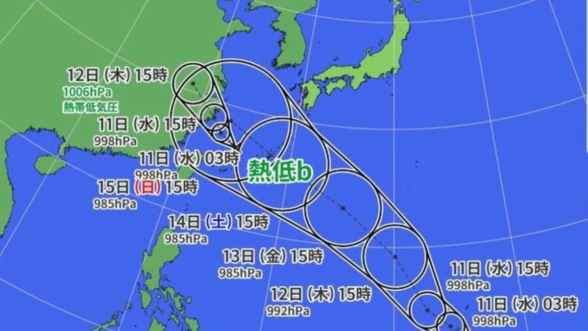
A tropical depression formed near the Mariana Islands around 6:00 a.m. on September 10, according to the Japan Meteorological Agency. Moving slowly west-northwest, the system is gaining strength and could develop into Typhoon No. 13 by the morning of September 11. This potential typhoon may impact the Okinawa region during the upcoming three-day holiday weekend.
The tropical depression currently has a central pressure of 1,002 hectopascals. Wind speeds near its center reach up to 15 meters per second, with maximum instantaneous gusts of 23 meters per second. These conditions signal that the system is strengthening as it progresses along its path.
Meteorologists are closely monitoring the depression’s development, as its trajectory could pose significant risks to the Okinawa region. Should it evolve into a typhoon, it may bring severe weather conditions, including heavy rainfall and strong winds, which could disrupt holiday plans and impact daily life.
The Japan Meteorological Agency’s forecast suggests that the depression will continue to intensify over the next 24 hours. Residents and authorities in the Okinawa region are advised to stay informed about the latest updates and prepare for potential impacts. The agency’s ongoing assessments will provide further details on the storm’s strength and its potential trajectory as the system evolves.
Given the timing of the potential typhoon, which coincides with a long weekend, there are concerns about possible travel disruptions and safety risks. The agency emphasizes the importance of preparation and vigilance as the situation develops.